Groundwater
We offer specialised geophysical surveys for groundwater exploration and management, helping clients locate aquifers, assess recharge zones, and monitor water quality.
Techniques such as electrical resistivity tomography (ERT), ground penetrating radar (GPR), and electromagnetic methods allow us to map subsurface hydrogeology with high resolution. Our services support sustainable water resource development for agriculture, industry, and municipal use, providing essential data for informed decision making and long-term planning.
At Zonge Geophysics, we have extensive experience in the groundwater industry. Electrically-based geophysical techniques are well suited to image variations in near-surface conductivity associated with location of aquifers and aquifers, as well as with groundwater quality.
Historical fact
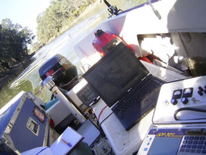
Instream NanoTEM data being collected on the River Murray in 2019.
In the late 1980s, Zonge USA developed one of the first (possibly the very first) TEM instrument designed to provide high-resolution information about the top 50 to 80m of the subsurface. This was pioneering work in this space. We continue to use the NanoTEM system along with the myriad of new techniques that have been developed over the last ten or 15 years to image groundwater.
